Six display panels have been installed around the Brecks to celebrate and tell the story of the rivers at that location – recreation history, trade and industry, ecology and more.
Links to more info relating to each of the panels below.
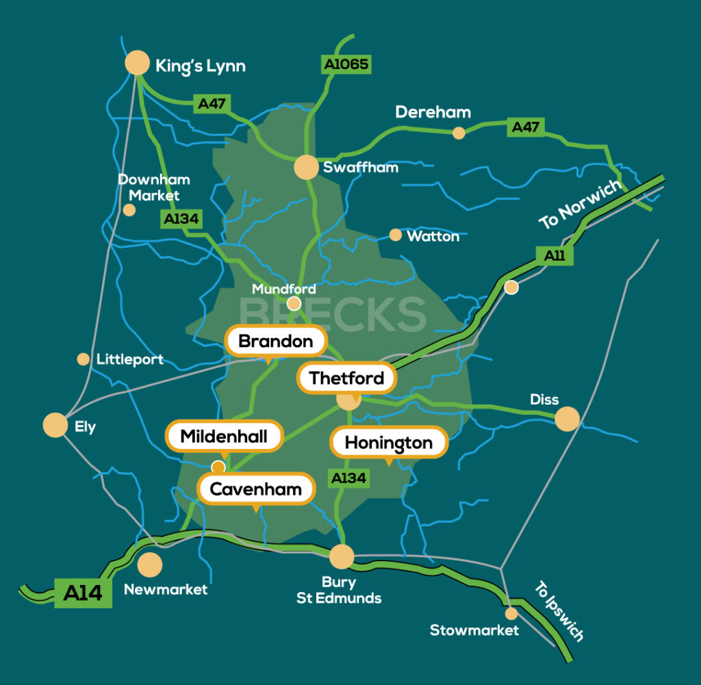
A Google map shows the locations, so you can get directions.
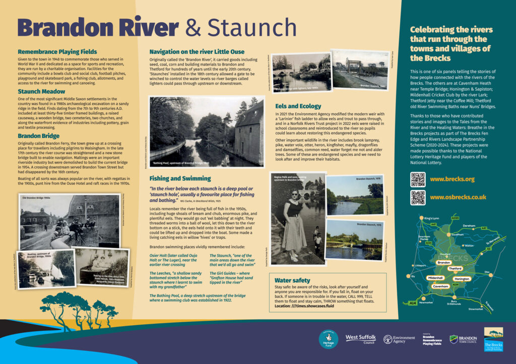
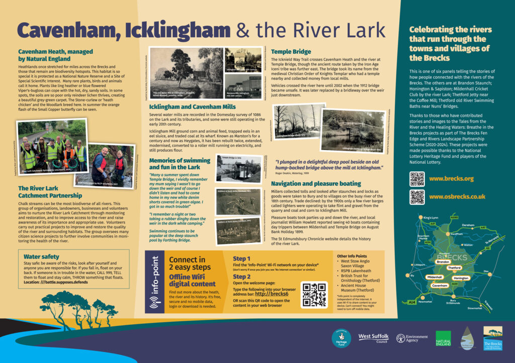
Brandon Staunch; Cavenham Heath/Temple Bridge
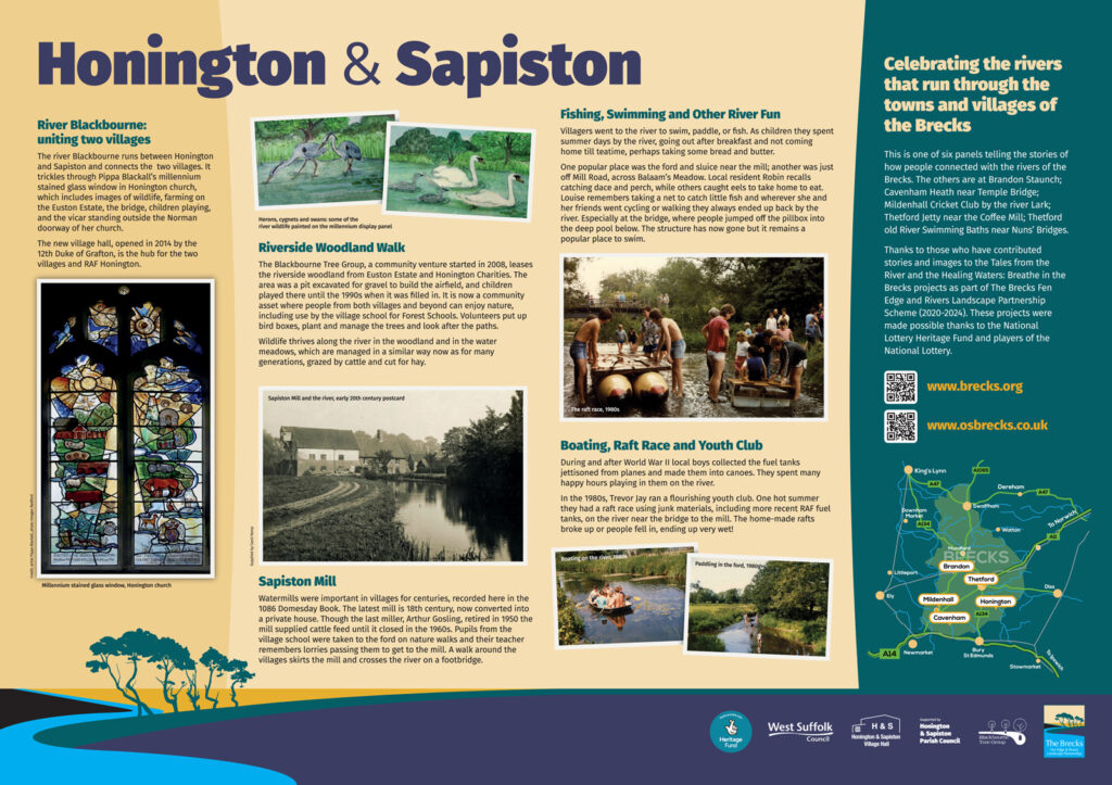
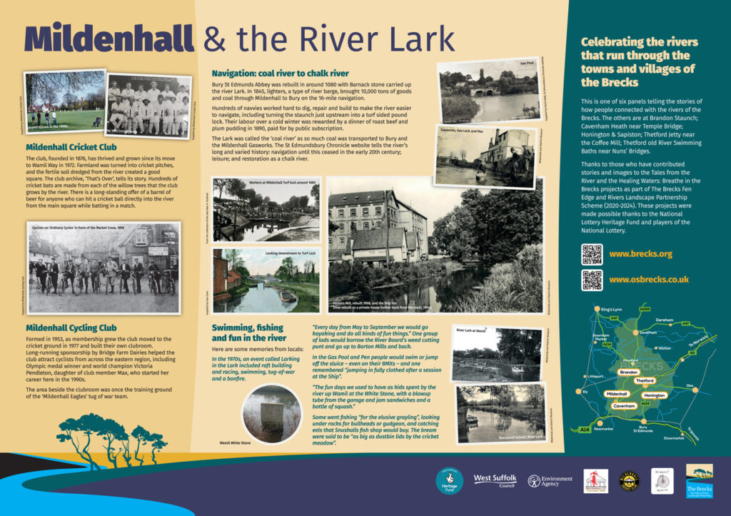
Honington & Sapiston; Mildenhall Cricket Club
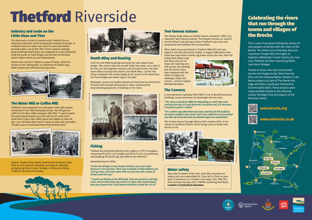
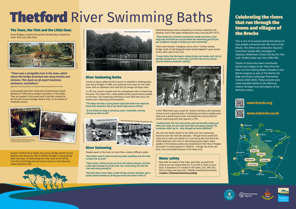
Thetford Riverside; Thetford River Swimming Baths
The interpretation panels were put together in the Healing Waters project, using material gathered by volunteers in the Tales from the River and Industrious Rivers projects, part of The Brecks Fen Edge and Rivers Landscape Partnership Scheme, supported by the National Lottery Heritage Fund. Some of the panels include key concise water safety info developed within the project.
At Cavenham/Temple Bridge you can access off-line web content using your smart phone (Info Point).
Thanks to hosting landowners and partners: @Natural England, @RiverLarkCatchmentPartnership, @EnvironmentAgency, @Wild Suffolk Swimmers, @BrandonTownCouncil, @Thetford Town Council, @Bush Adventures, Honington & Sapiston Parish Council, Brandon Remembrance Playing Fields, Mildenhall Cricket Club, Mildenhall Cycling Club, and to local people, groups and museums who let us use their images and stories.
See photos on Flickr.
At most of the locations we have done guided river history walks – find out more on the page about them by clicking on the icons on the Google maps of those walks and downloading the handout.
See more information relating to each of the panels: [more to come]
- Brandon Staunch: Ecology Information
- Honington & Sapiston (by the river jetty)
- Mildenhall Cricket Club by the river Lark: Mildenhall Cricket Club memories; Mildenhall Cycling Club
- Temple Bridge/Cavenham Heath
- Thetford Riverside (jetty)
- Thetford River Swimming Baths (near Nuns Bridges)